
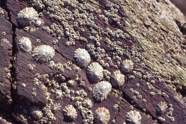
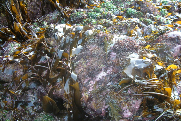
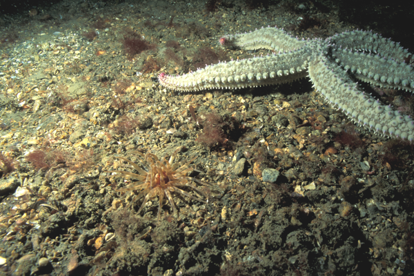
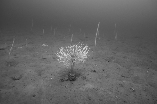
Benthic habitats
The extent to which Good Environmental Status has been achieved
Benthic habitats overall have not achieved Good Environmental Status (GES). While there has been improvement in some areas, the overarching situation is one of continued deterioration, particularly for threatened and declining habitats for both the Celtic Seas and the Greater North Sea.

Curled octopus (Elidone cirrhosa) on circalittoral rock. Photo from Natural England, credit: Ross Bullimore.
Progress since previous assessments
The 2024 results show that GES has not been met in either the Celtic Seas or Greater North Sea for many broad scale and listed (special) habitat types. Additionally, for some habitats the extent to which GES has been achieved is uncertain.
Overall, results from the 2024 assessments on physical disturbance (Fisheries bottom-towed gear), physical loss, and changes in condition are similar to those from the 2019 assessments, where GES had not been achieved for some benthic habitats, such as sand and mud habitats. A direct comparison with the assessment in 2012 is not possible as those were primarily focused on impacts from fishing gear using an expert judgment approach. There have, however, been improvements in some areas, in particular the reduction of fishing pressures in some habitats.
The number of assessment units in which indicators could be assessed in 2024 has decreased compared to 2019. This decrease was due to a general reduction in monitoring programmes, including a reduction in some of the Water Environment Regulations (WER) coastal monitoring and limited new data from Scotland, where the monitoring programmes, needed to assess most of the benthic WER indicators, have stopped.
Despite the limitations with monitoring data in some areas, there have been some improvements in indicator methods for the 2024 benthic assessments. This is the case for the opportunistic macroalgal growth, soft sediment benthic habitat communities (using relative Margalef species diversity), and intertidal rocky community responses to temperature change (MarClim) indicators, which were not fully developed or not used in the 2019 Part 1 update to assess GES targets. The assessments undertaken in 2024 also include three new methods to assess: area of habitat loss, changes to sensitive species (Sentinels of the Seabed), and the extent of physical disturbance from aggregate extraction. As these are new indicators for this assessment period, trends cannot be explored.
How progress has been assessed
Assessment overview
The assessment of benthic habitats was undertaken using a variety of biodiversity indicators and assessment methods applied at different scales. Due to limited data and scientific evidence, it was not possible to undertake a fully integrated assessment of benthic habitats at this stage. Therefore, the categories applied in Table 1 were based on expert opinion and are not the result of an aggregation method, which is currently not available for benthic habitats.
UK benthic habitats have been assessed using twelve indicators (Table 1). In a few cases the indicators are either pilots or there is insufficient information to provide GES thresholds, however the results still provide important contextual information and evidence.
Table 1. Summary overview of the status for Benthic Habitats (D1 and D6) indicator assessments.
|
Criteria 1 |
Spatial extent of physical loss |
|
2019 Target |
The physical loss of each seabed habitat type caused by human activities is minimised and where possible reversed. |
|
Indicator (OSPAR QSR 2023) |
Area of Habitat Loss (Pilot only for Greater North Sea) |
|
Greater North Sea |
Uncertain |
|
Celtic Seas |
Assessment unavailable |
|
Criteria 2 |
Habitat Condition |
|
2019 Target |
Habitat loss of sensitive fragile or important habitats caused by human activities is prevented, and where feasible reversed. |
|
Indicator |
Potential Physical Loss of Predicted Biogenic Habitats |
|
Greater North Sea |
Not met |
|
Celtic Seas |
Not met |
|
Criteria 3 |
Spatial Extent of habitat type adversely affected by physical disturbance |
|
2019 Target |
The extent of habitat types adversely affected by physical disturbance caused by human activity should be minimised. |
|
Indicator (OSPAR QSR 2023) |
Extent of Physical Disturbance to Benthic Habitats: Fisheries with mobile bottom-contacting gears |
|
Greater North Sea |
Not met |
|
Celtic Seas |
Not met |
|
Indicator (OSPAR QSR 2023) |
Extent of Physical Disturbance to Benthic Habitats: Aggregate extraction |
|
Greater North Sea |
Met |
|
Celtic Seas |
Met |
|
Criteria 4 |
Extent of adverse effects |
|
2019 Target |
The extent of adverse effects caused by human activities on the condition, function and ecosystem processes of habitats is minimised |
|
Indicator |
Condition of Intertidal Seagrass Communities in Coastal Waters Determined using Water Environment Regulations Methods |
|
Greater North Sea |
Met |
|
Celtic Seas |
Met |
|
Indicator |
Condition of Intertidal Saltmarsh Communities in Coastal Waters Determined using Water Environment Regulations Methods |
|
Greater North Sea |
Not met |
|
Celtic Seas |
Met |
|
Indicator |
Condition of Soft Sediment Invertebrate Communities in Coastal Waters Determined using Water Environment Regulations Methods |
|
Greater North Sea |
Met |
|
Celtic Seas |
Met |
|
Indicator |
Condition of Intertidal Rocky Shore Macroalgae (seaweed) Communities in Coastal Waters Determined using Water Environment Regulations Methods |
|
Greater North Sea |
Not assessed |
|
Celtic Seas |
Met |
|
Indicator |
Condition of Intertidal Sediments in Coastal Waters Determined using Water Environment Regulations Opportunistic Macroalgae Blooming Assessment Methods |
|
Greater North Sea |
Not met |
|
Celtic Seas |
Not met |
|
Indicator (OSPAR QSR 2023) |
Condition of Benthic Habitat Communities based on the ‘Relative Margalef’ diversity index |
|
Greater North Sea |
Uncertain |
|
Celtic Seas |
Not met |
|
Indicator |
Intertidal Community Temperature Index (MarClim) |
|
Greater North Sea |
Uncertain |
|
Celtic Seas |
Uncertain |
|
Indicator |
Sentinels of the Seabed (Pilot) |
|
Greater North Sea |
Uncertain |
|
Celtic Seas |
Uncertain |
Please note that an additional indicator: ‘Extent of Physical Disturbance to Benthic Habitats: Offshore structures and other activities’ is still under development. Thresholds for the ‘Intertidal Community temperature Index (MarClim)’ and ‘Sentinels of the Seabed’ indicators to assess GES are also under development
Detailed assessments
Criteria 1: Spatial extent of physical loss
Area of Habitat Loss (Pilot Assessment)
The results from the Area of Habitat Loss pilot assessment in the Greater North Sea, indicate that risk of habitat loss is low for most broad scale habitat types assessed, although it should be noted that limited activity data was used, and new licensing activities were not included. For biogenic reefs, according to the OSPAR QSR Benthic Habitats Thematic Assessment, the risk of loss in some areas was moderate.
Criteria 2: Habitat Condition
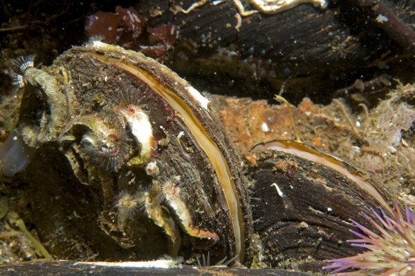
The threshold for the Potential Physical Loss of Predicted Biogenic Habitats (horse mussel reefs and eelgrass beds) indicator was not achieved in either the Greater North Sea or the Celtic Seas.
Criteria 3: Spatial Extent of habitat type adversely affected by physical disturbance
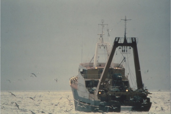
The OSPAR assessment of physical disturbance on benthic habitats from fisheries using mobile bottom-contacting gears indicates that most broad scale habitats in the Greater North Sea sub-region did not achieve GES across all assessment units. In contrast, over 68% of broad scale habitats in the Celtic Seas sub-region met GES. For OSPAR Threatened and/or Declining (T&D) habitats, between 43% and 60% achieved GES. However, in both the Northern and Southern Celtic Seas, at least half of the T&D habitats failed to reach GES. This resulted in the indicator not meeting GES overall for the Celtic Seas. For more details on the indicator assessment and GES thresholds developed for the UK.
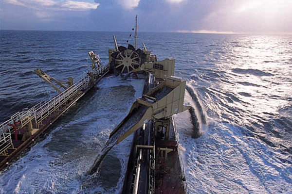
This is the first time that a specific indicator for physical disturbance from aggregate extraction has been used to assess GES in the UKMS. Commercial aggregate extraction activity is a licensed activity and was therefore confined to discrete areas within UKMS sub-regions. In the four assessment units where commercial aggregate extraction was assessed, all broad scale habitats achieved the threshold value for GES against disturbance from this pressure. Commercial aggregate extraction activity only overlapped with one OSPAR T&D habitat, Sabellaria spinulosa reefs, in the Southern North Sea assessment unit, where the threshold value for GES was achieved for aggregate extraction disturbance. For more details on the indicator assessment and GES thresholds developed for the UK.
Criteria 4: Extent of adverse effects
The extent to which GES has been achieved in intertidal habitats has mixed results:
-
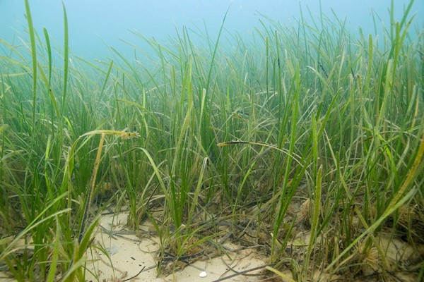
Condition of intertidal seagrass communities in coastal waters determined using Water Environment Regulations methods (WER) Methods. Achieved GES in both the Celtic Seas and Greater North Sea, although there is low confidence in the results.
-
Condition of intertidal saltmarsh communities in coastal waters determined using Water Environment Regulations methods (WER) Methods. Appears to be consistent with achieving GES in the Celtic Seas, but not the Greater North Sea, although there is low confidence in the results.
-
Condition of soft sediment invertebrate communities in coastal waters determined using Water Environment Regulations methods (WER) Methods. Achieved GES across intertidal, inshore and offshore habitats in both the Celtic Seas and Greater North Sea, although there is low confidence in the results.
-
Condition of intertidal rocky shore macroalgae (seaweed) communities in coastal waters determined using Water Environment Regulations methods (WER) Methods. Appears to be consistent with achieving GES in the Celtic Seas, although there is low confidence in the results. However, there was no data to assess this indicator in the Greater North Sea.
-
Condition of intertidal sediments in coastal waters determined using Water Environment Regulations (WER) opportunistic macroalgae blooming assessment methods. Is not consistent with achieving GES in either the Celtic Seas or the Greater North Sea, as there is low confidence in the results.
Extent thresholds for the condition of soft sediment invertebrate and of intertidal rocky shore macroalgae (seaweed) communities in coastal waters determined using Water Environment Regulations methods were updated from 85% in the 2019 assessments to 75% in the current assessment.
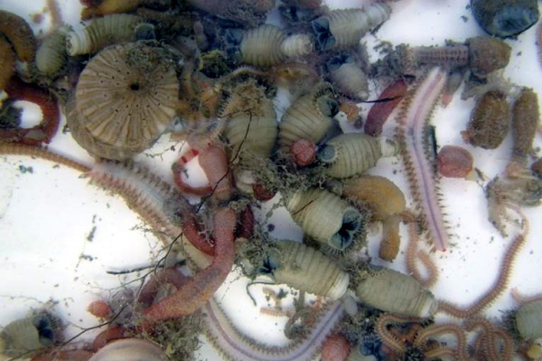
The assessment of changes of condition on subtidal soft sediment benthic communities using the Relative Margalef diversity index shows that in the Celtic Seas, GES was achieved in 32% of assessments and not achieved in 68% of assessments where adequate data was sufficient to calculate the indicator. In the Greater North Sea, indicator results were published in the Quality Status Report’s (QSR) Benthic Habitats Thematic Assessment (OSPAR, 2023b) but not analysed for GES assessment because the threshold values were not agreed in time for its publication. However, the results indicate low relative diversity in circalittoral sandy habitats and infralittoral sand and mud due to impacts from anthropogenic pressures.
The assessment of intertidal rock community response to changes in temperature showed that there had been relatively small changes in the Intertidal Community Index. This is in line with expectations from the changes in sea surface temperature, which did not show a strong trend over the time period of the surveys which finished in 2022. However, in 2023 and 2024, sea surface temperatures were the highest on record (Copernicus Climate Change Service/ECMWF) so changes may be evident during the next cycle.
An assessment of changes to biological traits of benthic communities indicates that impact from trawling is widespread in areas where monitoring data were available, although there is uncertainty in some areas, especially in the Celtic Seas due to limitations from monitoring programmes.
The confidence in all the indicator assessments is generally low due to the lack of recent data. For some habitats, the extent to which GES has been achieved is unknown due to a lack of data from monitoring programmes with which to calculate the indicator assessments.
Achievement of targets and indicators used to assess progress in 2024

Photographic credits: Intertidal Community Index ©JNCC. Intertidal seagrass © Paul Naylor. Intertidal saltmarsh © Environment Agency. Intertidal rocky shore © Environment Agency. Relative Margalef’ diversity index © Keith Hiscock. Extent of Physical Disturbance to Benthic Habitats: Fishing mobile gears © Mark Tasker; Extent of Physical Disturbance to Benthic Habitats: Aggregate extraction © British Marine Aggregate Producers Association. Infaunal quality index © Environment Agency. Potential Physical loss of Predicted Biogenic Habitats © Environment Agency. Area of habitat loss © OSPAR. Opportunistic macroalgae © Natural England/Trudy Russell. Sentinels of the Seabed © Keith Hiscock.
Drivers, activities and pressures affecting the state of the marine environment
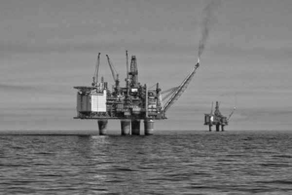
As highlighted in the OSPAR thematic assessment , benthic habitats are impacted by activities operating and/or interacting with the biotic and abiotic components of the seafloor, often at multiple spatial and temporal scales, and social and economic drivers have the potential to influence the status of benthic species and habitats. In the UK, drivers such as new renewables developments, continued oil exploration and new carbon capture and storage all have the potential to affect benthic habitats.
Activities with the potential to affect benthic habitats include:
-
Shipping
-
Fish and shellfish harvesting
-
Extraction of minerals
-
Tourism and leisure
-
Renewable energy
-
Submarine cables
-
Oil and gas
-
Agriculture and aquaculture.
These activities lead to a wide and varied list of pressures including, but not limited to:
-
Physical disturbance
-
Physical loss
-
Input of nutrients and organic matter, including those from storm overflows
-
Input of other substances such as heavy metals
-
Extraction of, or mortality of, wild species
-
Input or spread of non-indigenous species
-
Input of litter
-
Input of other forms of energy
-
Human-induced climate change.
Additional information can be found on the human activities section of the Benthic Habitats page of the OSPAR QSR (OSPAR, 2023a & OSPAR, 2023d).

Velvet swimming crab (Necora puber) in Zostera beds. Photo from Natural England, credit: Caitlin Napleton.
Impact of pressure on ecosystem services
Benthic habitats perform essential ecological functions such as maintaining the balance of marine food webs that support the existence of aquatic life including species of commercial and cultural importance. Habitats act as a natural barrier against flooding, and can help regulate water and sediment quality, having clear financial, social and wellbeing benefits for communities. They also sequester carbon, therefore, mitigating climate change. Human activities cause physical disturbance (e.g. bottom-contact fishing) and loss to these habitats and impact their condition (nutrient and organic matter enrichment) which has knock-on effects on the wide range of ecosystem services that they provide.
The evaluation of marine ecosystem services using benthic indicators is showing that poor status caused by physical disturbance and impact from nutrient enrichment is likely to cause strong negative impacts on water and sediment quality, regulation and maintenance of food-webs, nursery and other biotic provisioning and coastal protection services.
The relationship between benthic habitat condition and ecosystem service delivery is generally clearer for provisioning services compared with other service categories. This relationship is suggesting that poor condition/status would lead to a decline in services. Costs of degradation may be available for some habitats and geographic scales (Bayraktov and others, 2015; Hawkins and others, 2016; Ware and Callaway 2019).
Impacts of climate change on pressures and state
Climate change and ocean acidification cause direct and indirect pressures which can significantly alter the environmental conditions (e.g. decreases in pH, increases in sea surface temperature) necessary for benthic ecosystem processes and functions. These changes can affect habitat suitability for sensitive benthic species, species distributions, community structure and diversity patterns (Harley and others, 2006; Hoegh-Guldberg and Bruno 2010; Poloczanska and others, 2013; Gattuso and others, 2015; Nagelkerken and Connell 2015; Poloczanska and others, 2016).
Datasets available to systematically measure the effects of climate change and ocean acidification are limited, however, there is a large volume of evidence of the impacts across different regions. The main drivers impacting benthic habitats are: Ocean acidification, increased sea temperature, increased freshwater inputs and changed salinity, slowed Atlantic Meridional Overturning Circulation (AMOC), changes to rate of nutrient enrichment, increased sea level (including sea level rise at the coast, and coastal erosion), and heatwaves (for additional information visit the climate change section of the OSPAR QSR Benthic Habitats Thematic Assessment) (OSPAR, 2023c).
Benthic habitats can also provide solutions for the mitigation and adaptation of the effects of climate change. The natural carbon storage and sequestration capacity of some benthic habitats, such as seagrass and saltmarsh, highlights their important role in the context of climate change and mitigation of carbon inputs into the atmosphere from human activities. Some benthic habitats, such as saltmarsh, also provide natural flood and erosion protection.
The benthic biodiversity component has one indicator assessing response to changes in sea surface temperature on intertidal rock communities. The results of the Intertidal Community Temperature Index (MarClim) indicator show that changes in the intertidal community index are in line with expectations from temperature fluctuations in the region. With the years 2023 and 2024 being the warmest on record, the results of the Intertidal Community Temperature Index (MarClim) suggest that the change in community composition in the coming decade will be much larger.
Management actions taken
The actions we are taking to achieve GES for Benthic Habitats are set out in the UK Marine Strategy Part 3 2025: Programme of Measures.
Actions taken by the UK in relation to the management of specific human activities or pressures all contribute to addressing impacts from pressures and should, theoretically, contribute to improving the status of benthic habitats. There are some good examples, such as aggregate extraction licencing, showing that the impact from the activity is not causing a failure of indicator thresholds, and the restoration of saltmarsh habitats which is contributing to the achievement of GES.
UK Fisheries Management Plans (FMPs) (a requirement of the Fisheries Act 2020) are currently being developed and agreed with the aim of ensuring the long-term sustainable harvesting of commercial stocks and provide a mechanism to address potential ecosystem-level impacts associated with specific fisheries. FMPs incorporate information on the potential impacts of each fishery on a selected suite of UKMS descriptors in which there is evidence for an impact pathway and to inform the development of fishery-specific mitigation strategies, where appropriate.
Other measures which are used to improve the status of benthic habitats include:
-
Environmental Impact Assessments and marine licensing
-
Marine Spatial Planning including marine plans developed under the Marine and Coastal Access Act
-
Habitat Regulations
-
MPAs and the introduction of Highly Protected Marine Areas (HPMAs) in English waters.
However, stronger links between the results of this assessment and decision-making underpinning marine management and marine planning are needed to ensure measures are effective in supporting the achievement of GES, in particular, across sectors at a more strategic level, and in relation to the expansion of offshore renewables developments (and associated export cables). Overall, the current level of GES failure is indicating that some of the existing measures are not effective at reducing the continued deterioration of many benthic habitats.
Next steps
Evidence challenges
Protection of benthic habitats from disturbance, particularly from future pressures that we do not yet fully understand, such as deep-sea mining, is a noteworthy challenge and one further exacerbated by limited knowledge of deep-sea ecological functioning, data paucity for those habitats and limited biodiversity conservation measures and actions.
There are also still gaps in the assessment programmes concerning the effects of aggregate extraction, dredging and disposal of sediments or coastal defence structures, emerging pressures from development of offshore renewables (cables and structures), biological pressures from species harvesting or the spread of non-indigenous species, chemical pressures such as pollution by contaminants, and the combined background pressures of climate change and ocean acidification.
The biggest challenge will be to balance the protection of benthic habitats with the need to achieve Net Zero through activities like new renewables developments, continued oil exploration and new carbon capture and storage.
Operational objectives
The actions we are taking to achieve GES for Benthic Habitats are set out in the Programme of Measures. These contribute to the wider OSPAR-level strategic responses (detailed in the OSPAR QSR) (OSPAR, 2023a). We will work towards delivery of a strategic approach to management, monitoring and research to enable Benthic Habitats to move towards GES, through application of published and forthcoming strategies which outline the key actions required. We will continue to enhance and protect benthic habitats through:
-
Working towards the delivery of a strategic approach to management, monitoring and assessment to enable benthic habitats to move towards GES.
-
Working with neighbouring countries in OSPAR to establish indicators and thresholds to assess the extent of physical and habitat loss/disturbance and the extent of adverse effects on the condition of benthic habitats where feasible and appropriate.
-
Leading, in collaboration with Norway, on the development of an OSPAR Regional Action Plan for Benthic Habitats to define a coordinated framework of regional actions to be taken by Contracting Parties to improve the status of benthic habitats in the Northeast Atlantic
-
Completing a well-managed and ecologically coherent MPA network. We expect all MPAs in the UK to have the appropriate management measures and licencing structures in place by 2026. Area Based Conservation Measures, such as MPAs, are expected reduce pressures on benthic habitats.
-
Working with relevant bodies to facilitate the use of indicators and GES values to inform the efficiency of management interventions, such as those related to Fisheries Management Plans, Marine Spatial Planning and licencing processes, such as Environmental Impact Assessment (EIA).
Technical Detail: Good Environmental Status for the next cycle
Table 2. shows the overarching targets (characteristics) for GES, along with their criteria, individual GES targets and associated indicators for the next assessment cycle (subject to change following the UK Marine Strategy Part 1 public consultation).
Table 2. GES criteria and targets for next assessment cycle.
|
Overarching target |
|||||||
|
The health of seabed habitats is not significantly adversely affected by human activities |
|||||||
|
Criteria |
2024-2030 GES targets |
Comment |
Indicators to be used |
||||
|
Extent of physical loss |
Habitat loss of sensitive fragile or important habitats caused by human activities is prevented, and where feasible reversed (should not exceed a set of agreed indicator thresholds) |
Refined wording from minimised to prevented |
|
||||
|
Spatial extent of habitat type adversely affected by physical disturbance |
The extent of habitat types adversely affected by physical disturbance caused by human activity should be minimised (should not exceed a set of agreed indicator thresholds) |
No change |
|
||||
|
Spatial extent of habitat loss |
The extent of loss of a seabed habitat type caused by human activities is minimised and where possible reversed (should not exceed a set of agreed indicator thresholds) |
Refined wording to indicate importance of all habitats |
|
||||
|
Extent of adverse effects on the condition of benthic habitats |
The extent of adverse effects caused by human activities on condition, function and ecosystem processes of habitats is prevented, and where feasible reversed (should not exceed a set of agreed indicator thresholds) |
Refined wording to clarify that this is referring to condition and that adverse effects should be prevented and reversed where feasible |
|
||||
References
Bayraktov, E., Saunders, M. I., Abdullah, S., Mills, M., Beher, J., Possingham, H. P., Mumbry, P. J. and Lovelock, C, E. (2015) ‘The cost and feasibility of marine coastal restoration. Ecological Applications, 26 (4). Available at: https://doi.org/10.1890/15-1077.
Copernicus Climate Change Service/ECMWF (2024). Available at: https://climate.copernicus.eu/
Gattuso, J.P., Magnan, A., Billé, R., Cheung, W.W., Howes, E.L., Joos, F., Allemand, D., Bopp, L., Cooley, S.R., Eakin, C.M. and Hoegh-Guldberg, O. (2015) ‘Contrasting futures for ocean and society from different anthropogenic CO2 emissions scenarios’, Science, 349(6243), p.aac4722. Available at: https://www.science.org/doi/10.1126/science.aac4722
Harley, C.D., Randall Hughes, A., Hultgren, K.M., Miner, B.G., Sorte, C.J., Thornber, C.S., Rodriguez, L.F., Tomanek, L. and Williams, S.L. (2006) ‘The impacts of climate change in coastal marine systems’, Ecology letters, 9(2), pp.228-241. Available at: https://onlinelibrary.wiley.com/doi/epdf/10.1111/j.1461-0248.2005.00871.x
Hawkins, J. P., O’Leary, B. C., Bassett, N., Peters, H., Rakowski, S., Reeve, G. and Roberts, C. M. (2016) ‘Public awareness and attitudes towards marine protection in the United Kingdom. Marine Pollution Bulletin, 111 (1-2). Available at: https://doi.org/10.1016/j.marpolbul.2016.07.003
Hoegh-Guldberg, O. and Bruno, J.F. (2010) ‘The impact of climate change on the world’s marine ecosystems’, Science, 328(5985), pp.1523-1528. Available at: https://www.science.org/doi/10.1126/science.1189930
Matear, L., Vina-Herbon, C., Woodcock, K.A., Duncombe-Smith, S.W., Smith, A.P., Schmitt, P., Kreutle, A., Marra, S., Curtis, E.J., and Baigent, H.N. 2023. Extent of Physical Disturbance to Benthic Habitats: Fisheries. In: OSPAR, 2023: The 2023 Quality Status Report for the Northeast Atlantic. OSPAR Commission, London. Available at: https://oap.ospar.org/en/ospar-assessments/quality-status-reports/qsr-2023/indicator-assessments/phys-dist-habs-fisheries/
Matear, L., Vina-Herbon, C., Woodcock, K.A., Duncombe-Smith, S.W., Smith, A.P., Schmitt, P., Kreutle, A., Curtis, E.J., and Wade, K. 2023. Extent of Physical Disturbance to Benthic Habitats: Aggregate Extraction. In: OSPAR, 2023: The 2023 Quality Status Report for the Northeast Atlantic. OSPAR Commission, London. Available at: https://oap.ospar.org/en/ospar-assessments/quality-status-reports/qsr-2023/indicator-assessments/phys-dist-habs-agg-ex/
MOAT (2024) Marine Online Assessment Tool. Available at: https://moat.cefas.co.uk/ (Accessed 7th May 2025)
Nagelkerken, I. and Connell, S.D. (2015) ‘Global alteration of ocean ecosystem functioning due to increasing human CO2 emissions’, Proceedings of the National Academy of Sciences, 112(43), pp.13272-13277. Available at: https://www.pnas.org/doi/full/10.1073/pnas.1510856112
OSPAR (2023a) OSPAR Quality Status Report - https://oap.ospar.org/en/ospar-assessments/quality-status-reports/qsr-2023/ (Accessed 7th May 2025)
OSPAR (2023b) Benthic Habitats Thematic Assessment. In: OSPAR, 2023: Quality Status Report 2023. OSPAR Commission, London. Available at: https://oap.ospar.org/en/ospar-assessments/quality-status-reports/qsr-2023/thematic-assessments/benthic-habitats/(Accessed 7th May 2025)
OSPAR (2023c) Climate Change Thematic Assessment. In: OSPAR, 2023: Quality Status Report 2023. OSPAR Commission, London. Available at: https://oap.ospar.org/en/ospar-assessments/quality-status-reports/qsr-2023/thematic-assessments/climate-change/ (Accessed 7th May 2025)
OSPAR (2023d) Human Activities Thematic Assessment. In: OSPAR, 2023: Quality Status Report 2023. OSPAR Commission, London. Available at: https://oap.ospar.org/en/ospar-assessments/quality-status-reports/qsr-2023/thematic-assessments/human-activities (Accessed 7th May 2025)
Poloczanska, E.S., Brown, C.J., Sydeman, W.J., Kiessling, W., Schoeman, D.S., Moore, P.J., Brander, K., Bruno, J.F., Buckley, L.B., Burrows, M.T. and Duarte, C.M. (2013) ‘Global imprint of climate change on marine life’, Nature Climate Change, 3(10), pp.919-925. Available at: https://doi.org/10.1038/nclimate1958
Poloczanska, E.S., Burrows, M.T., Brown, C.J., García Molinos, J., Halpern, B.S., Hoegh-Guldberg, O., Kappel, C.V., Moore, P.J., Richardson, A.J., Schoeman, D.S. and Sydeman, W.J. (2016) ‘Responses of marine organisms to climate change across oceans’, Frontiers in Marine Science, p.62. Available at: https://doi.org/10.3389/fmars.2016.00062
Schmitt, P., Vina-Herbon, C. and Matear, L. 2023. Pilot Assessment of Area of Habitat Loss. In: OSPAR, 2023: The 2023 Quality Status Report for the North-East Atlantic. OSPAR Commission, London. Available at: https://oap.ospar.org/en/ospar-assessments/quality-status-reports/qsr-2023/indicator-assessments/areahabitat-loss-pilot
Ware, J. and Callaway, R. (2019) ‘Public perception of coastal habitat loss and habitat creation using artificial floating islands in the UK’. PLoS ONE 14(10): e0224424. Available at: https://doi.org/10.1371/journal.pone.0224424
Wijnhoven, S., Walvoort, D. and Schilder, J. 2023. Condition of Benthic Habitat Communities: Margalef diversity in region II (Greater North Sea) In: OSPAR, 2023: The 2023 Quality Status Report for the North-East Atlantic. OSPAR Commission, London. Available at: https://oap.ospar.org/en/ospar-assessments/quality-status-reports/qsr-2023/indicator-assessments/condition-benthic-hab-margalef/
Contributors
Laura Pettit and Cristina Vina-Herbon
Acknowledgements: Adam Britton, Stefano Marra, Kirsty Woodcock, Lauren Molloy and Adam Smith with contributions from members of the Benthic Subgroup of the Healthy and Biologically Diverse Seas Evidence Group and the Healthy and Biologically Diverse Seas Evidence Group (HBDSEG).