
Assessment of distribution of breeding and non-breeding marine birds.
This indicator measures whether the spatial distribution pattern of marine birds in the UK have significantly changed. The indicator target has been met at the UK level and at the level of OSPAR Regions, for breeding and non-breeding waterbirds. However, this is with low confidence due to data on seabird species and offshore regions not being included.
Background
UK target on bird distribution
This indicator on the distribution of breeding and non-breeding marine birds was developed to assess progress against the following target, which is set in the UK Marine Strategy Part 1 (DEFRA, 2019a): “At the scale of the UK Marine Strategy sub-regions, distribution of marine birds is not significantly affected by human activities. No major shifts or shrinkage in the population distribution of marine birds in 75% of species monitored.”
This indicator on the distribution of breeding and non-breeding marine birds was developed to assess progress against the following target, which is set in the UK Marine Strategy Part 1 (DEFRA, 2019a): "There is no significant change or reduction in population distribution caused by human activities. No major shifts or shrinkage in the population distribution of marine birds in 75% of species monitored." The Strategy specifies that this is met when there are no major shifts in species’ distributions (shift index = 0.7 or more), and no major declines in occupancy (Occupancy Rate decrease of 10% or more). 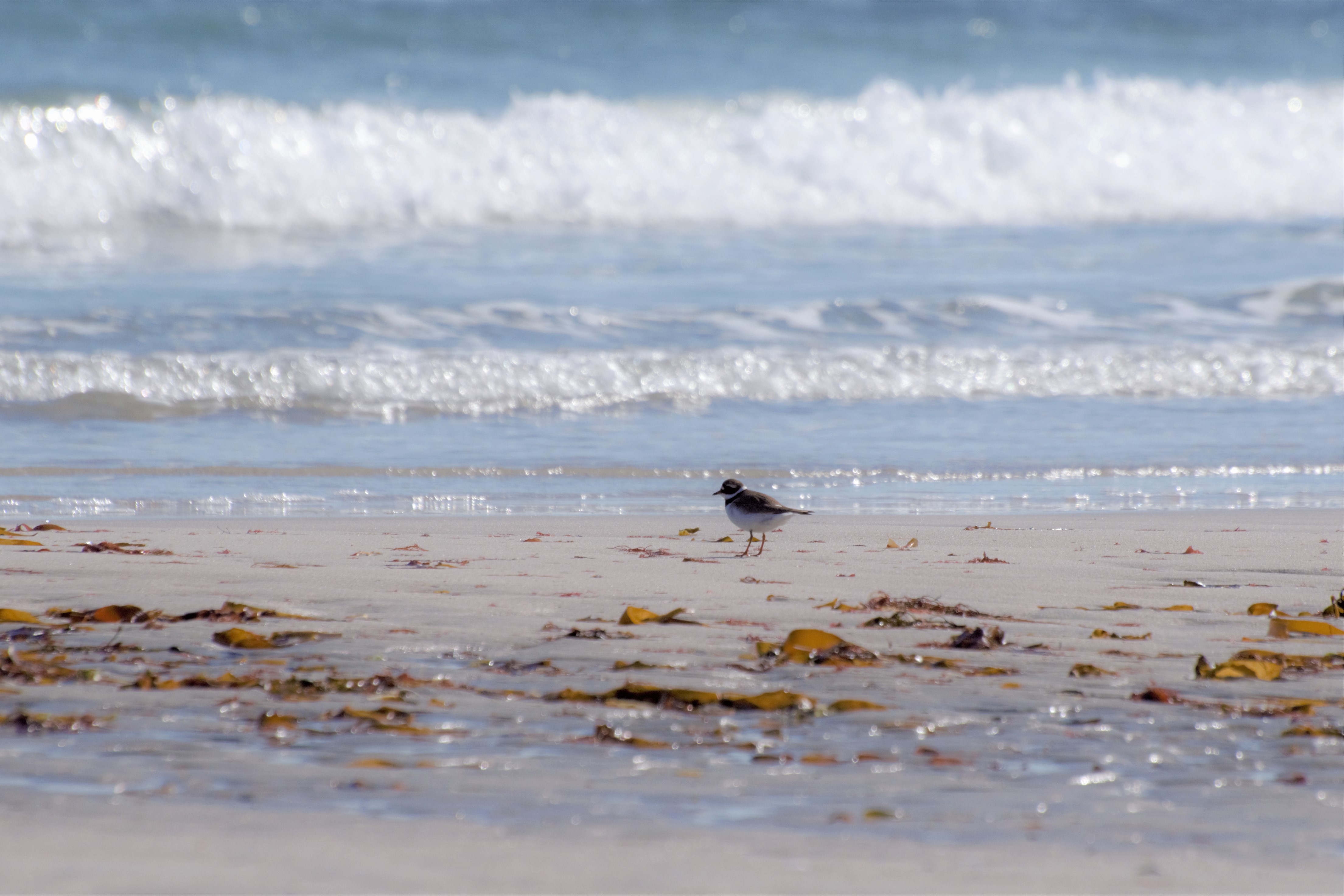
Ringed Plover are one of the species included in this indicator. (Photo credit: Daisy Burnell)
Key pressures and impacts
Changes in the distribution of marine birds along non-estuarine coasts could be caused by human activities such as coastal developments and flood defences impacting breeding habitats and intertidal feeding areas. Pressures such as shipping, offshore renewables and aggregate extraction could potentially change the distribution of marine birds like Red-throated Diver and other ‘traditional’ seabirds both during winter and in the breeding season. This indicator may also reflect prevailing climatic conditions (see MCCIP report card) . For example, outside the breeding season warmer winters in recent decades are thought to have caused a north-eastward shift in the UK distribution of some wader and waterfowl species.
Measures taken to address the impacts
Measures to protect marine birds from human activities leading to habitat loss, such as suitable breeding sites and foraging areas, are set out in the UK Marine Strategy Part 3 (DEFRA, 2019b). These include those taken under the EU Birds Directive and the planning, assessment, and licensing of coastal developments. Direct conservation measures, such as the one aiming to restore saltmarsh habitat at Blackwater estuary, also aim to mitigate negative impacts of human activities as well as provide resilience in a changing climate.
Further information
Introduction
In addition to the initial four marine bird indicators during the 2018 assessment, a pilot indicator of marine bird distributions was developed by Humphreys and others (2015) with the aim to determine the progress towards the UK Marine Strategy target of “no significant change or reduction in population distribution of marine birds caused by human activities” (DEFRA, 2019a). In combination with the established indicators on abundance trends (Mitchell and others, 2018), an indicator on distribution changes can provide insight into the impacts of some pressures, such displacement or habitat loss from coastal developments and flood defences impacting breeding habitats and intertidal feeding areas.
However, the pilot indicator on marine bird distributions from 2018 (Humphreys and others, 2015) was limited in scope in terms of species and geographical area. During a review of the pilot indicator in 2022 (Woodward and others, in prep), the robustness of the metrics used to assess marine bird distributions, the thresholds used in the assessments, the range of species covered, and the geographical range were reassessed. As a result, changes have been applied to improve the current indicator assessment on marine bird distributions. These changes are described in more detail in the section “Changes made in 2023 to the marine bird distribution indicator” in the Methods. The updated indicator is now based on only one metric (changes in ‘Occupancy Rate’) describing changes in the range of species, assessed separately for coastal breeding waterbird species during the breeding season and for non-breeding waterbirds during winter.
Species under consideration
This indicator is only suitable for certain species of marine birds that tend to aggregate in inshore areas or at onshore breeding or roosting sites, for which distributional patterns can be accurately measured and are likely to indicate anthropogenic impacts.
The species included in the current assessment rely on inter-tidal areas for foraging, and their distribution can be affected by the loss of habitat to coastal developments or as a result of disturbance.
In this context, like that of the marine bird abundance indicator, marine birds include species in two commonly aggregated groups: waterbirds and seabirds.
Like in the pilot assessment from 2018, the current assessment focusses on waterbirds. Breeding seabird distributions, even though there is also potential for impacts from coastal habitat loss, were not considered due to there being no agreed method for analysing the data thus far.
All species defined as waterbirds by Wetlands International (Rose & Scott, 1997) are considered. In the UK, this includes swans, geese, ducks, divers, grebes, herons, Spoonbill, rails, cranes, waders and Kingfisher. The Wetlands International definition of waterbirds also includes cormorants, shags, gulls and terns. These species are considered as seabirds in other indicators within the UK Marine Strategy and are thus excluded here, with the exception of cormorants which are included in the Non-breeding Waterbird Distribution Assessment for consistency with the Non-breeding Waterbird Abundance Indicator that forms part of the UK Marine Strategy and OSPAR indicator on marine bird abundance.
Two separate assessments of distributional change were carried out for the following:
-
Coastal breeding distribution of 14 waterbird species
-
Non-breeding distribution of 56 waterbird species
For the Coastal Breeding Waterbird Distribution Assessment, only waterbird species breeding in candidate tetrads (areas included in the assessment) were considered. As the Atlas data, upon which this analysis was based, did not include information whether breeding waterbirds present in a tetrad were using freshwater habitats or coastal habitats in the tetrads, an assessment of species habitat preferences has been made and species have been excluded from the analysis if they are unlikely to use coastal waters during the breeding season in the majority of cases (Woodward and others, in prep). As a result of this process, the Coastal Breeding Waterbird Indicator was assessed based on the Atlas data of 14 species: shelduck Tadorna tadorna, mallard Anas platyrhynchos, common eider Somateria mollissima, red-breasted merganser Mergus serrator; oystercatcher Haematopus ostralegus, avocet Recurvirostra avosetta, lapwing Vanellus vanellus; ringed plover Charadrius hiaticula, curlew Numenius arquata, dunlin Calidris alpina, snipe Gallinago gallinago, redshank Tringa totanus, red-throated diver Gavia stellata and grey heron Ardea cinerea.
For the Non-breeding Waterbird Distribution Assessment, most native waterbird species were included in the assessment, leading to a total of 56 waterbird species under consideration. The exceptions were wintering swans and grey geese (Anser) species, where the available data were deemed unreliable as these species, although roosting at coastal sites, often fly inland to feed during the day and could easily be missed during counts. In addition, these species provide only little evidence about the health of the marine environment, hence they were excluded from the analysis. Shags are technically covered by the two surveys used for this assessment, however, they have been excluded due them being a relatively new addition (no data in 1998, therefore no baseline) to the species suite.
It is recognised that some of the species, notably waterbirds (shorebirds and wildfowl), may not be considered ‘marine birds’ by many observers. However, the list of species included was determined by the previous marine bird abundance indicator (Mitchell and others, 2018) and those deemed to be dependent on the marine environment by a joint JNCC and statutory nature conservation body review (JNCC 2011). A total of four species (Moorhen, Water Rail, Jack Snipe and Common Sandpiper) were additional to these resources. These were included under the assumption that presence of the species in coastal tetrads during winter is a reliable indication of marine environment use during that season (Woodward and others, in prep).
Future assessments
In the future, this indicator could also be derived from information on breeding colonies of terns, gulls, cormorants and shags. Like the waterbird species included in this indicator, the breeding distribution of these species would be affected by coastal habitat loss and by the introduction of non-native and native predatory mammals to island colonies. Currently, species distribution indicators for breeding terns, gulls, cormorants and shags cannot be constructed for this assessment because of insufficient data availability. Results of the most current breeding seabird census, Seabirds Count, were not available in time for this assessment. However, these could be used to assess distributional change for these species between Seabirds Count and the previous census Seabird 2000. Assessments were also not possible for non-breeding gulls due to limitations in matching data from the 2003/04 and the 2005/06 Winter Gull Roost Survey and equivalent past surveys, along with the lack of data at the tetrad scale for the first winter atlas. These issues will hopefully be overcome, and these groups of species can be included in future assessments.
Anthropogenic impacts from renewable energy developments, dredging, and shipping, are known to affect the distribution of inshore aggregations of sea ducks, divers and possibly grebes. However, there are no systematic UK-wide monitoring programmes for these inshore waterbirds. Changes in the distribution of large cliff-nesting seabird colonies such as guillemot, razorbill, kittiwake, and fulmar do not provide useful indicators of anthropogenic impacts. Impacts on seabirds, at large cliff-colonies, driven by pressures such as limiting their food supply through fishing or direct mortality through fishing by-catch, are likely to be detected more readily by abundance indicators rather than those assessing distributional change. This is because the distribution of these colonies is largely determined by the distribution of suitable sea cliffs and the relative nest-site faithfulness these species have (i.e. they do not change breeding sites regularly, if at all).
Assessment method
To assess whether distributions of marine birds are significantly affected by human activities, the ‘Change in Occupancy Rate’ is determined, which describes the extent of shrinkage or expansion in a species’ range. Note that this contrasts with the last assessment, where two metrices (Change in Occupancy Rate, and a Shift Index) were used, see ‘Changes made in 2023 to the marine bird distribution indicator’ below.
Due to the lack of both seabird and inshore/offshore data, the indicator is limited in what it can assess. Therefore, for this assessment, it is only possible to assess if human activities, that impact coastal and estuarine habitats, are significantly affecting distributions of marine birds that use these habitats.
Data for the Coastal Breeding Waterbird Distribution Assessment
Changes in the distribution of coastal breeding waterbirds were assessed using datasets from two successive breeding bird Atlases of Britain and Ireland, covering the periods 1988–1991 (Gibbons and others, 1993) and 2007–2011 (Balmer and others, 2013). These Atlases collected data at two scales: at a 10 x 10 km square level and from individual tetrads within 10 km squares. Tetrads are a 2 km x 2 km grid system aligned to the Ordnance Survey national grid. A total of 18,015 candidate tetrads were identified. Candidate tetrads include all those intersected by the low tide mark together with all those intersected by a one-kilometre-wide buffer inland of the high-tide mark.
Data for the Coastal Breeding Waterbird Distribution Assessment were taken from Timed Tetrad Visits (TTVs). Volunteer observers made two visits within each tetrad in which TTVs were carried out, the first during April or May and the second during June or July. Presence/absence data for breeding waterbirds were extracted from the Atlas data, based on the list of candidate tetrads. Of the 18,015 candidate tetrads, TTV data were available for 9,388 tetrads, of which data from 4,717 were retained for the analyses as they were covered during the surveys for both for Gibbons and others (1993) and Balmer and others (2013).
TTV data from the 2008–2011 Atlas were adjusted to remove any observations made during the second hour of the TTV. This was done to ensure that observer effort from the two Atlases was comparable, as TTV visits lasted for one hour only during the 1988-1991 Atlas, but observers were given the option to continue for a second hour during the 2008-2011 Atlas.
The Atlas data records of presence and absence from TTVs are likely to include some non-breeding individuals, including both immature birds and passage birds en route to breeding grounds elsewhere. To retain only records of breeding individuals, for each species only those records were used where there are separate records of probable or possible breeding at a location, obtained from data collected by Gillings and others (2019). If there was no breeding record available it was assumed that the tetrad record referred to a passage or non-breeding individual and was excluded from the analysis (Woodward and others, in prep).
Data for the Non-breeding Waterbird Distribution Assessment
Changes in the distribution of non-breeding waterbirds during the period 1997/98 to 2006/07 were assessed using count data from the WeBS Core Count scheme (collected at sector level) and from the Non-Estuarine Waterbird Surveys (NEWS) organised by the BTO (Austin and others, 2017). Although the WeBS Core scheme covers all wetland habitats, the additional inclusion of NEWS data is essential as WeBS coverage of the open coast is sparse. Analyses considered data on species’ presence or absence on the shore during the winter when birds were either roosting just above the high tide mark (most WeBS counts) or feeding on exposed intertidal areas including coastal lagoons and saltmarsh at low tide (most NEWS counts). Note that data from an additional NEWS survey in 2015/16 (NEWS III, Humphreys and others, 2020) have become available since Humphreys and others (2015). Consequently, the period assessed for the non-breeding indicator has been extended to compare NEWS III (2015/16) and NEWS I (the baseline year: 1997/98) (Woodward and others, in prep).
WeBS Core Count sectors and NEWS count stretches were assigned to the candidate tetrads which they intersected. Where WeBS Core Count sectors or NEWS stretches intersected more than one tetrad, counts were allocated to tetrads proportionally according to the percentage of the sector/stretch falling within each tetrad, with counts rounded to the nearest whole number. Counts were then translated into presence/absence data (‘absent’ being zero birds recording although a count had been carried out) (Woodward and others, in prep).
Of the 18,015 candidate tetrads, 8,535 were intersected by WeBS Core Count sectors and/or NEWS stretches covered during the target periods. Target periods were constrained to align to the periodic NEWS surveys: NEWS-I Jan 1998; NEWS-II Jan 2007; NEWS-III Jan 2016. Consequently, WeBS Core Count data were restricted to the standard January visits for each of those years.
When considering the data it is important to consider whether a species is absent because no birds selected this location, even though they could have done, or whether the area is outside the species’ potential range, or the habitat is unsuitable. Past presence of a species is a good indicator for suitable habitats conditions for that species within the region. When calculating change in Occupancy Rate it is possible that the extent of occupancy loss across suitable habitat may be underestimated if large stretches of coastline which are unlikely to ever hold a given species are included. It is therefore possible that substantial declines in species across suitable habitat may remain hidden and prevent any action to halt or reverse the decline being taken.
To address this a species-specific ‘mask’ was created to remove areas where a species had never been recorded during WeBS counts or NEWS surveys; that region was considered to be outside of the geographic or habitat range of that species and was not further considered in the analysis for that species. To ensure that exceptional species records did not compromise this approach, a 2% occurrence in a region as the lowest value indicative of occupancy was set, rather than 0 (Woodward and others, in prep).
Whilst this mask is necessary for the reasons stated, it should be noted that in some cases this excludes habitats which might be suitable in the future, when the range of a species shifts. If the range of a species varies over time, assessments based on different time periods may thus be based on a slightly different sample of tetrads as a consequence of adjustments to the mask (Woodward and others, in prep).

Eider is a species that is considered in both the coastal breeding and non-breeding waterbird components of this indicator. (Photo credit: Mark Lewis).
Change in Occupancy Rate
The change in Occupancy Rate was calculated as detailed in Woodward and others (in prep): The Change of Occupancy Rate equals the percentage occupancy in the baseline period minus the percentage occupancy in the subsequent period. This is different from calculating the percentage difference in the absolute number of tetrads occupied (see Box 1 for further explanation). The latter lacks reference to the total number of tetrads in an area without which it is not possible to assess the statistical significance of any apparent differences.
|
Box 1. Calculation of change in percentage occupancy for distributional pattern: Change in Occupancy Rate = [(B/N) – (A/N)] x 100 where ‘A’ is the number of spatial units (e.g. tetrads) occupied by species x during the baseline period A, and ‘B’ is the number of units occupied in the subsequent period of interest, and N= the total number of spatial units within the region. Worked example: Number of unit area occupied in survey period A = 56 Number of unit area occupied in survey period B = 28 Number of tetrads in the region = 560 Therefore, the change in percentage occupancy = [(28/560) – (56/560)] x 100 = - 5% For comparison, the change in percentage occupancy using the percentage change in the absolute number of squares occupied would have been: [(B-A)/A] x 100 = [(28-56)/56] x 100 = -50% |
Significance of percentage change in occupancy was assessed using a general additive model (function gam, library mgcv, Wood, 2011), with a binomial error distribution comparing presence or absence (1,0) at the region level. Latitude and longitude were included as a smoothed interaction term as a proxy to account for spatial autocorrelation, with latitude calibrated to the same scale as longitude. This method, however, did not perform well at the boundaries of extinction or colonisation (i.e. zero or 1 in one or other of the survey periods). Therefore, in these cases we used a chi-squared test to provide level of significance for change in occupancy but note that in such cases we therefore do not allow for spatial autocorrelation. Note also that P-values for low sample size and power are considered only approximate and should be treated with caution.
Calculation if assessment target has been met
The assessment target has been met in a particular area if the Occupancy Rate has been stable (is not declining by >10%) for more than 75% of species assessed. For example, if there were 12 species assessed for a given area, and only 6 showed a stable Occupancy Rate, the target would not be met: (6/12) x 100 = 50%. This metric is calculated separately at the different spatial scales for coastal breeding waterbirds and non-breeding waterbirds, with the UK level metric being the key measure.
Changes made in 2023 to the marine bird distribution indicator
Focus on Occupancy Rate Index
In the first pilot assessment in 2018, the indicator on marine bird distribution was based on two metrics – Distributional Pattern and Distributional Shift – which were produced separately for both coastal breeding waterbirds and non-breeding waterbirds (Humphreys and others, 2015; Mitchell and others, 2018).
-
Distributional Pattern was measured through change in ‘Occupancy Rate’ – this described the extent of shrinkage or expansion in a species’ range.
-
Distributional Shift was measured through a ‘Shift Index’ – this described the extent to which the species’ distribution had shifted from one area to another.
These metrics were effective at describing changes in distribution, but it proved more challenging to use the results to assess progress towards the UK target on bird distribution.
When the metrics were revisited in 2022, including additional data, it appeared that the Shift Index metric might be sensitive to biases introduced by the detectability of a species during individual visits (Woodward and others, in prep). Due to this metric being intrinsically linked to Occupancy Rate, for many species, the sensitivity in the shift index was likely to be a function of both their presence and detectability. Consequently, significant shifts were observed to mainly occur for species with low-medium occupancy (Humphreys and others, 2015) resulting in uncertainty about the reliability of the metric. Significant shifts may therefore not be robust in cases where detectability is important (Woodward and others, in prep).
In addition, Woodward and others (in prep) found that the Shift Index may be particularly sensitive for species whose ranges are strongly contracting or expanding. And whilst the Shift Index can identify changes in distribution in both expanding and declining species, it is less likely to do so in declining species as wintering individuals of many species are often site-faithful and changes in occupation of tetrads may be less likely to be detected (Woodward and others, in prep).
Due to the issues described above, Woodward and others (in prep) recommended to drop the Shift Index metric from the marine bird distribution Indicator assessment. The current assessment is therefore based only on Occupancy Rates, calculated for coastal-breeding waterbirds in the breeding season and for non-breeding waterbirds during winter, to indicate distributional change.
Expanding geographical coverage
The 2018 pilot assessment for the UK was restricted to seven species of waterbird that breed and seven species that spend the non-breeding season along non-estuarine coasts. Data were restricted to only coastal sites that are adjacent to ‘marine waters’ as defined under the UK Marine Strategy (Introduction to UK Marine Strategy - Marine online assessment tool (cefas.co.uk)). This restriction was assumed because the UK Marine Strategy Regulations do not apply to transitional waters such as estuaries. The restriction reduced confidence in the assessment for species that use estuarine as well as coastal habitat and limited the number of species for which sufficient data were available for inclusion in the indicator. Excluding transitional waters from the indicator also presented problems for the selection and analysis of data as some survey units included both coastal and transitional waters.
The UK Marine Strategy and OSPAR indicator on marine bird abundance (Mitchell and others, 2018) was later expanded to include both marine and transitional waters to be consistent with neighbouring countries. This is because, in some of these countries the distinction between marine and transitional waters may be less clearcut than it is on UK estuaries, for example, at the Wadden Sea in the Netherlands and Germany. Expanding the geographical coverage of the distribution indicator to include estuaries made it more relevant to coastal and inshore management and reduced potential biases introduced by using data from only parts of survey units in the vicinity of estuaries.
Woodward and others (in prep) investigated the impacts of expanding the Marine Bird Distribution Indicator to include data from estuaries and other transitional waters. They found no substantial effect on the number of species for which the metric thresholds were not met, at any spatial scale, hence transitional waters were retained in the current indicator assessment.
Extending species coverage
In the initial pilot assessment, Humphreys and others (2015) defined ‘marine birds’ as a wide range of taxonomic groups, including: shorebirds (order Charadriiformes, referring specifically to the families: Haematopodidae, Recurvirostridae, Charadriidae and Scolopacidae); wildfowl (Anseriformes i.e. swans, geese, ducks); divers (Gaviiformes); grebes (Podicipediformes); petrels and shearwaters (Procellariiformes); gannets and cormorants (Pelecaniformes); and skuas, gulls, terns and auks (order Charadriiformes referring specifically to the families Stercorariidae, Laridae, Sternidae, Alcidae). However, in practice that pilot work was restricted to consideration of coastal breeding waterbirds and non-breeding waterbirds, as breeding seabirds were excluded. And due to the restriction of this assessment to non-estuarine coasts, the number of species being assessed was limited to seven water bird species that breed in the UK and seven waterbird species that spend the non-breeding season in the UK.
In the current indicator assessment, estuarine sites have been included to consider all species which make use of the marine environment and for which data are available. This is in line with the suite of species upon which the Non-breeding Waterbird Abundance Indicator is based, which was also derived from the Wetland Bird Survey (WeBS) Core Count scheme data from coastal sites, and which includes 60 species of waterbirds in the Celtic Seas and 68 species in the Greater North Sea (Mitchell and others, 2018). This means that for coastal breeding waterbirds a further seven species were added and for non-breeding waterbirds a further 49 species were included, taking the total numbers up to 14 and 56, respectively.
However, the inclusion of additional species also caused changes in performance of the two metrics. For the Non-breeding Waterbird Distribution Indicator, the number of species for which the Shift Index was greater than 0.7 was substantially higher than was the case in the previous evaluation, when only seven species were assessed, and no species exceeded this threshold in either of the OSPAR regions (Humphreys and others, 2015). Further analysis was therefore carried out to determine whether the inclusion of additional species would highlight issues that were not evident in the previous small sample of species. A comparison of Shift Index value with mean percentage occupancy showed that almost all the high Shift Index rates (>0.7) at the OSPAR Region spatial scale occurred in species with less than 12.5% occupancy, and there were no high rates for species with greater than 25% occupancy. A repeat analysis for the 14 OSPAR reporting areas showed a similar pattern. This indicates that there is uncertainty about the reliability of the Shift Index for species with low Occupancy Rates, leading to the Shift Index to be dropped from current assessments.
Variation on the spatial scale of indicator assessments
In the last assessment of 2018, it was noted under ‘Knowledge gaps’ that “…future assessments would benefit from the addition of small-scale assessments, alongside sub-regional assessments, in order to provide a watching brief on the potential local anthropogenic impacts on marine bird distribution.” In the current indicator assessments, three scales were therefore used: UK wide assessments, assessments on the scale of the two OSPAR regions (Greater North Sea and Celtic Seas) and on the scale of OSPAR Reporting Areas.
Results
Finding from previous Assessments
In the first indicator assessment from 2018, a method was developed for a pilot analysis (Humphreys and others, 2015) and found that in both UK regions (UK Celtic Seas and UK Greater North Sea) the assessment target was met.
Latest findings
Summary results, as prepared by Woodward and others (in prep), are provided for both coastal breeding waterbirds and non-breeding waterbirds, at the spatial scales of the UK as well as at the scale of the two OSPAR regions for consistency with the previous assessment. Breeding results are based on the period between 1988–91 and 2007–11, and non-breeding results are based on the period between 1997/98 and 2015/16. The indicator target is met if more than 75% of species being assessed within an area meet the threshold for this indicator. The threshold for each species is a less than 10% decline in Occupancy Rate over the assessed time period.
In addition, the assessment has also been carried out at the scale of the OSPAR reporting areas as these can provide insights into small-scale distribution changes, which might indicate changes in the range of species before they become apparent on the larger indicator assessment scales. The detailed results of those assessments can be found in Woodward and others (in prep) and are summarised below.
UK wide assessment
At the UK-wide scale, the indicator target was met for coastal breeding waterbirds, with 92.9% of all species having an Occupancy Rate indicating declines of less than 10%. Of the 14 species assessed, only lapwing showed a decline in Occupancy Rate by more than 10% (13.31%), although eleven out of the fourteen species showed declines, with some approaching the 10% threshold (Table 1). Change in Occupancy Rate assesses the difference in percentage occupancy between two time points and is not necessarily immediately impacted by changes in abundance as a species in decline may still occupy an area but in lower numbers.
Table 1. Coastal Breeding Waterbird Occupancy Rate changes UK-wide. Red highlighted figures signify regions where target has not been met.
|
Species |
Occupancy Rate Change |
p value |
|
Avocet |
7.95 |
0 |
|
Curlew |
-8.47 |
0 |
|
Dunlin |
-1.15 |
0.176 |
|
Eider |
-4.75 |
0 |
|
Grey Heron |
-1.44 |
0.11 |
|
Lapwing |
-13.31 |
0 |
|
Mallard |
4.98 |
0 |
|
Oystercatcher |
1.35 |
0.15 |
|
Red-breasted Merganser |
-3.05 |
0.001 |
|
Redshank |
-7.19 |
0 |
|
Red-throated Diver |
-1.9 |
0.065 |
|
Ringed Plover |
-5.66 |
0 |
|
Shelduck |
-0.2 |
0.817 |
|
Snipe |
-3.82 |
0 |
For non-breeding waterbirds, the indicator target was met, as 100% of the 56 species assessed showed relatively stable Occupancy Rates (declines of <10%) (Table 2).
Table 2. Non-Breeding Waterbird Occupancy Rate changes UK-wide.
|
Species |
Occupancy Rate Change |
p value |
|
Avocet |
9.82 |
0 |
|
Barnacle Goose |
4.27 |
0 |
|
Bar-tailed Godwit |
-0.82 |
0.267 |
|
Black-necked Grebe |
0.35 |
0.682 |
|
Black-tailed Godwit |
4.48 |
0 |
|
Black-throated Diver |
0 |
1 |
|
Brent Goose |
6.3 |
0 |
|
Common Sandpiper |
-3.92 |
0.404 |
|
Common Scoter |
-2.17 |
0.008 |
|
Coot |
1.97 |
0.012 |
|
Cormorant |
5.35 |
0 |
|
Curlew |
1.03 |
0.302 |
|
Dunlin |
-5.64 |
0 |
|
Eider |
-5.6 |
0 |
|
Gadwall |
5.53 |
0 |
|
Golden Plover |
-0.65 |
0.414 |
|
Goldeneye |
-9.24 |
0 |
|
Goosander |
2.81 |
0 |
|
Great Crested Grebe |
0.13 |
0.885 |
|
Great Northern Diver |
9.04 |
0 |
|
Greenshank |
2.98 |
0 |
|
Grey Heron |
4.15 |
0 |
|
Grey Plover |
-3.36 |
0 |
|
Jack Snipe |
-6.15 |
0.128 |
|
Kingfisher |
8.82 |
0.037 |
|
Knot |
-0.95 |
0.257 |
|
Lapwing |
-3.19 |
0.001 |
|
Little Egret |
17.73 |
0 |
|
Little Grebe |
3.29 |
0 |
|
Long-tailed Duck |
-0.55 |
0.723 |
|
Mallard |
1.81 |
0.064 |
|
Moorhen |
2.02 |
0.001 |
|
Mute Swan |
1.86 |
0.01 |
|
Oystercatcher |
3.54 |
0 |
|
Pintail |
3.01 |
0 |
|
Pochard |
-3.19 |
0 |
|
Purple Sandpiper |
-2.1 |
0.008 |
|
Red-breasted Merganser |
-3.99 |
0 |
|
Redshank |
1.54 |
0.111 |
|
Red-throated Diver |
3.11 |
0 |
|
Ringed Plover |
-3.46 |
0 |
|
Ruff |
-1.85 |
0.035 |
|
Sanderling |
5.06 |
0 |
|
Scaup |
-2.95 |
0 |
|
Shelduck |
1.63 |
0.079 |
|
Shoveler |
4.11 |
0 |
|
Slavonian Grebe |
-1.63 |
0.114 |
|
Snipe |
2.72 |
0 |
|
Spoonbill |
15.94 |
0.002 |
|
Spotted Redshank |
0 |
1 |
|
Teal |
8.31 |
0 |
|
Tufted Duck |
0.3 |
0.619 |
|
Turnstone |
0.69 |
0.446 |
|
Velvet Scoter |
-0.65 |
0.625 |
|
Water Rail |
0.41 |
0.597 |
|
Whimbrel |
17.65 |
0.227 |
|
Wigeon |
6.19 |
0 |
OSPAR Region assessments
In both the Celtic Seas and the Greater North Sea OSPAR regions, the indicator target was met for coastal breeding waterbirds. Declines of less than 10% in Occupancy Rate were shown by 92.9% of all species in the Greater North Sea Region and by 85.7% of all species in the Celtic Seas, therefore being above the target rate of at least 75% of all species (Table 3). The two species failing to meet the target were lapwing (in both regions) and Curlew in the Celtic Seas region.
Table 3. Coastal Breeding Waterbirds Occupancy Rate changes in OSPAR regions. Red highlighted figures signify species where the target was not met in each OSPAR region.
|
Species |
Celtic Seas |
Greater North Sea |
||
|
Occupancy Rate Change |
p value |
Occupancy Rate Change |
p value |
|
|
Avocet |
4.65 |
0.129 |
8.43 |
0 |
|
Curlew |
-11.32 |
0 |
-4.86 |
0 |
|
Dunlin |
-1.5 |
0.088 |
-0.29 |
0.877 |
|
Eider |
-5.97 |
0 |
-2.56 |
0.176 |
|
Grey Heron |
-1.43 |
0.233 |
-1.45 |
0.285 |
|
Lapwing |
-11.97 |
0 |
-15.02 |
0 |
|
Mallard |
4.34 |
0.001 |
5.77 |
0 |
|
Oystercatcher |
-1.29 |
0.328 |
4.54 |
0 |
|
Red-breasted Merganser |
-3.88 |
0 |
-0.69 |
0.671 |
|
Redshank |
-5.84 |
0 |
-8.82 |
0 |
|
Red-throated Diver |
-1.2 |
0.272 |
-3.41 |
0.112 |
|
Ringed Plover |
-3.36 |
0.002 |
-8.41 |
0 |
|
Shelduck |
0.42 |
0.694 |
-1.09 |
0.444 |
|
Snipe |
-3.33 |
0.003 |
-4.48 |
0 |
For non-breeding waterbirds, too, the indicator target was met in both OSPAR regions, with 98.2% of the 55 species assessed in the Greater North Seas showing less than 10% declines in Occupancy rates, and 98.1% of the 52 species of the Celtic Seas region showing less than 10% declines in Occupancy Rates. In both regions only one species did not meet the target: black-throated diver Gavia arctica in the Greater North Sea (-13.8%), and long-tailed duck Clangula hyemalis in the Celtic Seas (-23.2%, Table 4).
Table 4. Non-breeding Waterbirds Occupancy Rate changes in OSPAR regions. Red highlighted figures signify species where the target was not met in each OSPAR region.
|
Species |
Celtic Seas |
Greater North Sea |
||
|
Occupancy Rate Change |
p value |
Occupancy Rate Change |
p value |
|
|
Avocet |
13.04 |
0.035 |
9.64 |
0 |
|
Barnacle Goose |
8 |
0 |
0.13 |
0.846 |
|
Bar-tailed Godwit |
-2.69 |
0.002 |
1.1 |
0.348 |
|
Black-necked Grebe |
0 |
1 |
0.53 |
0.594 |
|
Black-tailed Godwit |
-1.01 |
0.23 |
8.35 |
0 |
|
Black-throated Diver |
2.68 |
0.154 |
-13.79 |
0.019 |
|
Brent Goose |
8.27 |
0 |
5.07 |
0 |
|
Common Sandpiper |
0 |
1 |
-25 |
0.45 |
|
Common Scoter |
-1.82 |
0.205 |
-2.71 |
0.005 |
|
Coot |
1.42 |
0.167 |
2.24 |
0.031 |
|
Cormorant |
2.76 |
0.047 |
8.03 |
0 |
|
Curlew |
-3.11 |
0.025 |
5.25 |
0 |
|
Dunlin |
-4.62 |
0 |
-6.68 |
0 |
|
Eider |
-5.79 |
0 |
-5.52 |
0 |
|
Gadwall |
2.9 |
0.001 |
7.26 |
0 |
|
Golden Plover |
2.14 |
0.044 |
-2.88 |
0.011 |
|
Goldeneye |
-9.9 |
0 |
-8.98 |
0 |
|
Goosander |
3.47 |
0 |
0.54 |
0.691 |
|
Great Crested Grebe |
-0.92 |
0.312 |
1.51 |
0.232 |
|
Great Northern Diver |
10.54 |
0 |
7.17 |
0 |
|
Greenshank |
2.76 |
0.006 |
3.56 |
0.013 |
|
Grey Heron |
2.62 |
0.02 |
5.84 |
0 |
|
Grey Plover |
-5.6 |
0 |
-1.68 |
0.142 |
|
Jack Snipe |
0 |
1 |
-6.56 |
0.127 |
|
Kingfisher |
14.29 |
0.231 |
6.38 |
0.241 |
|
Knot |
-1.2 |
0.264 |
-0.67 |
0.561 |
|
Lapwing |
-1.3 |
0.326 |
-4.54 |
0 |
|
Little Egret |
13 |
0 |
22.97 |
0 |
|
Little Grebe |
1.15 |
0.142 |
5.76 |
0 |
|
Long-tailed Duck |
-23.23 |
0 |
1.91 |
0.26 |
|
Mallard |
-3.33 |
0.016 |
6.83 |
0 |
|
Moorhen |
0.54 |
0.491 |
3.17 |
0.001 |
|
Mute Swan |
0.45 |
0.64 |
3.03 |
0.003 |
|
Oystercatcher |
-0.51 |
0.669 |
7.46 |
0 |
|
Pintail |
1.97 |
0.088 |
3.71 |
0 |
|
Pochard |
-3.73 |
0 |
-2.99 |
0 |
|
Purple Sandpiper |
-0.88 |
0.31 |
-3.34 |
0.014 |
|
Red-breasted Merganser |
-6.41 |
0 |
-1.67 |
0.169 |
|
Redshank |
1.38 |
0.308 |
1.78 |
0.17 |
|
Red-throated Diver |
2.08 |
0.062 |
4.26 |
0.001 |
|
Ringed Plover |
-2.4 |
0.035 |
-4.43 |
0 |
|
Ruff |
NA |
NA |
-1.85 |
0.035 |
|
Sanderling |
3.96 |
0.001 |
6.18 |
0 |
|
Scaup |
-5.37 |
0 |
-1.4 |
0.123 |
|
Shelduck |
-1.11 |
0.388 |
4.29 |
0.001 |
|
Shoveler |
2.81 |
0 |
5.47 |
0 |
|
Slavonian Grebe |
-2.55 |
0.029 |
-0.67 |
0.699 |
|
Snipe |
1.8 |
0.058 |
3.67 |
0 |
|
Spoonbill |
14.29 |
0.231 |
16.67 |
0.01 |
|
Spotted Redshank |
NA |
NA |
0 |
1 |
|
Teal |
6.82 |
0 |
9.86 |
0 |
|
Tufted Duck |
0.06 |
0.937 |
0.52 |
0.556 |
|
Turnstone |
0.34 |
0.777 |
1.03 |
0.421 |
|
Velvet Scoter |
NA |
NA |
-0.65 |
0.625 |
|
Water Rail |
-0.96 |
0.121 |
1.47 |
0.197 |
|
Whimbrel |
17.65 |
0.227 |
NA |
NA |
|
Wigeon |
0.95 |
0.461 |
11.45 |
0 |
Further information
OSPAR Region assessment – further evidence
The significant declines in Occupancy Rate identified for breeding lapwing and curlew (Table 3) are both in line with current knowledge of these species, e.g. substantial declines in abundance described by Risely and others (2013) for Breeding Bird Survey (BBS) data, or other regional surveys of breeding waders in England and Wales (Wilson and others, 2005). For more details on this, and also a discussion of the non-simultaneous declines in breeding abundance and declines in breeding range see Woodward and others (in prep).
The decline in Occupancy Rate of wintering long-tailed duck is consistent with declines in abundance in Sweden during winter (Nilsson, 2016) and breeding declines in the Barents Sea (Karwinkel and others, 2020). For black-throated diver there is no prior knowledge about trends for this species hence we are lacking additional confirmation on possible reasons for declines. For more background on these results see Woodward and others (in prep).
OSPAR Reporting Areas assessment
In addition to the reporting at UK-wide scale and OSPAR region scale (see above), changes in Occupancy Rate at the smaller scale of OSPAR Reporting areas can be very insightful. In combination with the results of the Abundance Indicator (Mitchell and others, 2018), they can highlight small scale changes in distribution early, before distribution changes become apparent on larger scales.
At the small scale OSPAR Reporting Areas, and in contrast to the larger scale assessments, the indicator target was not met in all reporting areas for coastal breeding waterbirds. Relatively stable Occupancy Rates (declines of less than 10%) were shown by fewer than 75% of species in East Scotland (66.7% of species), in Northern Ireland (63.6% of species), in Southwest Scotland (69.2% of species) and in Wales (72.7% of species; Table 5).
Table 5. Percentage of coastal breeding waterbirds species in OSPAR reporting areas showing less than 10% declines in Occupancy Rates. Red highlighted figures signify reporting areas where target has not been met.
|
Region |
No. Species Assessed |
Pass rate at 10% Occupancy Rate threshold |
|
Northeast England |
12 |
91.70% |
|
Northwest England |
13 |
92.30% |
|
South England |
10 |
90% |
|
Southeast England |
11 |
81.80% |
|
Southwest England |
10 |
90% |
|
Southwest Scotland |
13 |
69.20% |
|
Northern Ireland |
11 |
63.60% |
|
East Scotland |
12 |
66.70% |
|
Moray Firth |
13 |
76.90% |
|
North Coast and Orkney |
13 |
76.90% |
|
Shetland |
11 |
81.80% |
|
West Scotland |
13 |
84.60% |
|
Western Isles |
13 |
76.90% |
|
Wales |
11 |
72.70% |
For non-breeding waterbirds, the indicator target was met in all reporting areas. Shetland was the OSPAR Reporting Area with the lowest percentage of species (81%) with relatively stable Occupancy Rates (Table 6).
Table 6. Percentage of non-breeding waterbirds species in OSPAR reporting areas showing less than 10% declines in Occupancy Rates.
|
Region |
No. Species Assessed |
Pass rate at 10% Occupancy Rate threshold |
|
Northeast England |
42 |
85.70% |
|
Northwest England |
41 |
97.60% |
|
South England |
49 |
95.90% |
|
Southeast England |
44 |
100% |
|
Southwest England |
47 |
89.40% |
|
Northern Ireland |
40 |
95% |
|
East Scotland |
43 |
86% |
|
Moray Firth |
34 |
100% |
|
North Coast and Orkney |
37 |
83.80% |
|
Shetland |
21 |
81% |
|
Southwest Scotland |
42 |
90.50% |
|
West Scotland |
33 |
90.90% |
|
Western Isles |
34 |
88.20% |
|
Wales |
44 |
97.70% |
For detailed results of the assessment at the OSPAR Reporting Area scale, please refer to Woodward and others (in prep).
Conclusions
This assessment has successfully demonstrated that changes in the distribution of marine birds in coastal and intertidal habitats (including near inshore areas) can be measured using a new method and be used to assess progress against the UK target for bird distribution. The results show that the indicator target has been met at the UK-wide scale and at the OSPAR Region scale.

Lapwing was the only coastal breeding species failing to meet target in both OSPAR regions. (Photo from Daisy Burnell).
This indicator includes additional species, including sea ducks, divers and grebes which overwinter in the shallow inshore waters of the UK, compared with the first pilot assessment from 2018. This goes some way to improving the ability of the indicator to detect displacement from inshore areas due to some human activities such as offshore renewable developments, dredging, aggregate extraction and shipping. However, the distribution data used for these species is limited in its spatial extent and does not cover wholly their inshore and offshore distribution. Without more extensive inshore and offshore data, detection of possible displacement could still be considered difficult to discern.
Further information
Changes in abundance vs changes in range
Abundance changes, as measured e.g. by Breeding Bird Survey data (Risely and others, 2013), do not necessarily translate to distribution changes immediately, as species in decline will often still be present across a similar range but in much smaller numbers. Large abundance declines may occur before significant changes in distribution become apparent. As an example, redshank breeding numbers declined by 42% during 1995–2011 (Risely and others, 2013), but the distribution of redshank did not decline by greater than 10% at the UK level or in either OSPAR region. However, the decline in abundance was mirrored by a decline in Occupancy Rate at the smaller spatial scale of OSPAR reporting areas (Woodward and others, in prep): declines of greater than 10% in Occupancy Rate of redshank occurred in five of the 14 OSPAR reporting areas. Thus, distribution indicator results from smaller spatial areas, taken in conjunction with the abundance indicator (Mitchell and others, 2018), may give early warning about species that are in danger of failing to meet distribution indicator thresholds in future years at UK or OSPAR region level.
Disentangling terrestrial and marine pressures for some species
It is important to highlight that for some species disentangling impacts from human activities happening exclusively in terrestrial or marine environments may be difficult. Curlew, for example, have possibly seen declines in breeding numbers due to land management changes and increased predators (Brown and others, 2015). These pressures are not marine and could be having an influence on those found predominantly in coastal areas. Similarly, Lapwing declines have been associated with agricultural practice change (Sheldon and others, 2004). This is not to say that pressures from human activities on the coast are also not playing a role in the Occupancy Rate changes seen in this assessment. The decline in ringed plover for example could be directly due to habitat loss from increased access at breeding areas (Conway and others, 2019). Careful consideration is needed when assessing both success and failures of measures for impacts seen at coastal and intertidal habitats. They are complex systems with pressures acting upon them from terrestrial and marine sources.
Knowledge gaps
Knowledge gaps
This indicator is currently suggested to have low confidence due to several limitations presented by the data included:
-
Lack of breeding seabird distribution data and wintering distribution data, such as winter gull roost and wintering shag distribution data.
-
Lack of accurate inshore and offshore distribution data for both wintering and breeding marine birds.
The inclusion of both of these aspects would greatly improve the reliability of this indicator to show distributional change caused by human activities both at the coast and in offshore habitats.
Further information
Future inclusion of colonial-breeding seabirds and winter distribution data of other seabird species.
It is worth noting that this project does not cover breeding seabirds, including colonial-breeding terns, gulls, cormorants and shags which all feed in inshore areas and could be affected by human impacts differently to the intertidal-feeders currently assessed. Mitchell and others (2018) recommended that in the future, this indicator should include such species. However, results from the latest census of breeding seabirds in Britain and Ireland – ‘Seabirds Count’ were not available in time to incorporate them into this assessment. Once these results are available, further work may be carried out to include breeding seabird distribution data in the indicator.
Inclusion of shags, for the non-breeding waterbird Occupancy Rate assessment should also be considered for inclusion in future assessments. This species was not included during this assessment as although it does have recent data, it is a relatively new addition the species suite for both WeBS and NEWS. Data was not collected in 1998, hence there is no baseline data available. Understanding how to incorporate this species into the indicator will be beneficial, especially as it strengthens the list with more ‘traditional’ marine birds.
Wintering distributions of gulls were not included in either this assessment or the previous one. Mismatches in sites between the two winter gull roost surveys meant not enough comparable data was available to reliably use with the assessment. Utilising any future survey data for gulls would be beneficial for this indicator, as like the addition of shag, would strengthen the species list with more ‘traditional’ marine birds.
Future inclusion of inshore and offshore distribution data for both wintering and breeding marine birds.
Currently, data for both offshore and inshore distributions of marine birds are patchy. The volunteer seabirds at sea (VSAS) programme has now been running along ferry routes in the west of Scotland for a number of years. It has subsequently started to expand into the English waters however, the ability to use this data within the context of this indicator is debatable, at least in the short term, unless a suitable baseline dataset for the areas covered was available. With the increase in offshore renewable developments, data on marine bird distributions are required for application purposes. However, these data are not easily accessible and again require a suitable baseline to understand potential change in distribution. Without these more extensive distribution data into offshore and inshore areas, the indicator will always be somewhat limited in its confidence.
References
Austin, G., Frost, T., Mellan, H., Balmer, D.E., 2017. Results of the third Non-estuarine Waterbird Survey, including population estimates for key waterbird species. BTO Research Report No. 697. British Trust for Ornithology, Thetford, UK.
Balmer, D.E., Gillings, S., Caffrey, B.J., Swann, R.L., Downie, I.S., Fuller, R.J., 2013. Bird Atlas 2007-11: the breeding and wintering birds of Britain and Ireland. British Trust for Ornithology, Thetford,
Brown, D., Wilson, J., Douglas, D., Thompson, P., Foster, S., McCulloch, N., Phillips, J., Stroud, D., Whitehead, S., Crockford, N., Sheldon, R., 2015. The Eurasian Curlew – the most pressing bird conservation priority in the UK? British Birds. 108. 660-668.
Conway, G.J., Austin, G.E., Handschuh, M., Drewitt, A.L., Burton, N.h.k., 2019. Breeding populations of Little Ringed Plover Charadrius dubius and Ringed Plover Charadrius hiaticula in the United Kingdom in 2007. Bird Study. 66(1). 22-31
Gibbons, D.W., Reid, J.B., Chapman, R.A., 1993. The new atlas of breeding birds in Britain and Ireland: 1988-1991. T. & A.D. Poyser, London, UK.
Gillings, S., Balmer, D.E., Caffrey, B.J., Downie, I.S., Gibbons, D.W., Lack, P.C., Reid, J.B., Sharrock, J.T.R., Swann, R.L., Fuller, R.J., 2019. Breeding and wintering bird distributions in Britain and Ireland from citizen science bird atlases. Global Ecology and Biogeography, 28(7), 866–874.
Humphreys, E.M., Austin, G.E., Thaxter, C.B., Johnston, A., Risely, K., Frederiksen, M., Burton, N.H.K., 2015. Development of MSFD indicators, baselines, and targets for population size and distribution of marine birds in the UK. Report to JNCC.
Humphreys, E.M., Austin, G.E., Frost, T.M., Mellan, H.J., Boersch-Supan, P., Burton, N.H.K., Balmer, D.E., 2020. Wader populations on the United Kingdom’s open coast: results of the 2015/16 Non-Estuarine Waterbird Survey (NEWS-III) and a review of population trends. Bird Study, 67(3), 371–384.
Karwinkel, T., Pollet, I.L., Vardeh, S., Kruckenberg, H., Glazov, P., Loshchagina, J., Kondratyev, A., Merkel, B., Bellebaum, J., Quillfeldt, P., 2020. Year-round spatiotemporal distribution pattern of a threatened sea duck species breeding on Kolguev Island, south-eastern Barents Sea. BMC Ecology, 20, 31.
Mitchell, I., French, G., Douse, A., Foster, S., Kershaw, M., McCulloch, N., Murphy, M., Hawkridge, J., 2018. Marine bird abundance. UK Marine Online Assessment Tool [Online]. Document]. Available from: https://moat.cefas.co.uk/biodiversity-food-webs-and-marine-protected-areas/birds/abundance/ (Accessed 10 10 2023).
Nilsson, L., 2016. Changes in numbers and distribution of wintering long-tailed ducks Clangula hyemalis in Swedish waters during the last fifty years. Ornis Svecica, 26, 162–176.
Risely, K., Massimino, D., Newson, S.E., Eaton, M.A., Musgrove, A.J., Noble, D.G., Procter, D., Baillie, S.R., 2013. The breeding bird survey 2012. BTO Research Report No. 645. British Trust for Ornithology, Thetford, UK
Rose, P.M., Scott, D.A., 1997. Waterfowl population estimates. Second Edition. Wetlands International Publication No. 44. Wetlands International, Wageningen, The Netherlands.
Sheldon, R., Bolton, M., Gillings, S., Wilson, A., 2004. Conservation management of Northern Lapwing Vanellus vanellus on lowland arable farmland in the UK. Ibis. 146. 41-49.
UKDEFRA, 2019a. Marine strategy part one: UK updated assessment and good environmental status. Department for Environment Food and Rural Affairs. Available from: https://www.gov.uk/government/publications/marine-strategy-part-one-uk-updated-assessment-and-good-environmental-status (Accessed 25 May 2023).
Wilson, A.M., Vickery, J.A., Brown, A., Langston, R.H.W., Smallshire, D., Wotton, S., Vanhinsbergh, D., 2005. Changes in the numbers of breeding waders on lowland wet grasslands in England and Wales between 1982 and 2002. Bird Study, 52, 55–69.
Wood, S.N., 2011. Fast stable restricted maximum likelihood and marginal likelihood estimation of semiparametric generalized linear models. Journal of the Royal Statistical Society Series B: Statistical Methodology, 73(1), 3–36.
Woodward, I., Austin, G.E., Boersch-Supan, P., Humphreys, E.M., Burton, N.H.K., in prep. Development of UK Marine Strategy Indicators on Marine Bird Distribution. Technical Report to JNCC report.
Authors
Lead authors: Daisy Burnell, Kerstin Kober, Ian D. Woodward, Graham E. Austin, Philipp Boersch-Supan, Elizabeth M. Humphreys and Niall H.K. Burton.
Supporting authors: Matthew Murphy, Jen Graham, Richard Berridge, Justin Hart, Claire Macnamara
Assessment metadata
| Assessment Type | UK Marine Strategy Assessment Part 1 (2025) – Indicator Assessment |
|---|---|
| Point of contact email | marinestrategy@defra.gov.uk |
| Metadata date | Thursday, May 1, 2025 |
| Title | |
| Resource abstract | |
| Linkage | |
| Conditions applying to access and use | UK Government Data policy |
| Assessment Lineage | UK Marine Strategy Part 1 Assessment in 2019: |
| Dataset metadata | |
| Dataset DOI | Breeding data: Breeding birds Atlases of Britain and Ireland: https://www.bto.org/get-involved/volunteer/projects/completed/birdatlas-2007-2011/results/mapstore Gibbons, D.W., Reid, J.B., Chapman, R.A., 1993. The new atlas of breeding birds in Britain and Ireland: 1988-1991. T. & A.D. Poyser, London, UK. Balmer, D.E., Gillings, S., Caffrey, B.J., Swann, R.L., Downie, I.S., Fuller, R.J., 2013. Bird Atlas 2007-11: the breeding and wintering birds of Britain and Ireland. British Trust for Ornithology, Thetford, Analysis for this indicator was contracted to and prepared by the British Trust for Ornithology who own the Atlas datasets. Non-breeding data: Wetland Bird Survey (WeBS): https://www.bto.org/get-involved/volunteer/projects/wetland-bird-survey/data Non-Estuarine Waterbird Surveys (NEWS): https://www.bto.org/our-work/science/publications/reports/research-reports/results-third-non-estuarine-waterbird-survey-including Data for NEWS can be requested via the WeBS data request form. |
The Metadata are “data about the content, quality, condition, and other characteristics of data” (FGDC Content Standard for Digital Geospatial Metadata Workbook, Ver 2.0, May 1, 2000).
Metadata definitions
Assessment Lineage - description of data sets and method used to obtain the results of the assessment
Dataset – The datasets included in the assessment should be accessible, and reflect the exact copies or versions of the data used in the assessment. This means that if extracts from existing data were modified, filtered, or otherwise altered, then the modified data should be separately accessible, and described by metadata (acknowledging the originators of the raw data).
Dataset metadata – information on the data sources and characteristics of data sets used in the assessment (MEDIN and INSPIRE compliance).
Digital Object Identifier (DOI) – a persistent identifier to provide a link to a dataset (or other resource) on digital networks. Please note that persistent identifiers can be created/minted, even if a dataset is not directly available online.
Indicator assessment metadata – data and information about the content, quality, condition, and other characteristics of an indicator assessment.
MEDIN discovery metadata - a list of standardized information that accompanies a marine dataset and allows other people to find out what the dataset contains, where it was collected and how they can get hold of it.